Garmin Jiaming Guyming Guyming Satellite Real Map American & Canadian Map Map


Вес товара: ~0.7 кг. Указан усредненный вес, который может отличаться от фактического. Не включен в цену, оплачивается при получении.
Описание товара

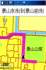


Гомополосная карта карты изображений джиаминга Garmin Bird Eye
Quickly transfer high-resolution satellite imagery to your Garmin handheld device to get a true representation of your surroundings with a 1 year subscription to BirdsEye Satellite Imagery.
Use your BirdsEye Satellite Imagery subscription with BaseCamp software to quickly transfer an unlimited amount of satellite images to your Garmin device and seamlessly integrate those images into your handheld’s maps whenever you need them.
- Transfer an unlimited number of satellite and aerial image segments to your device with this subscription and free software BaseCamp.
- High-resolution sub-meter color satellite imagery captures the world in brilliant clarity and detail.
- Allows you to layer the Garmin vector maps on your handheld (such as TOPO 100K, TOPO 24K or City Navigator) with BirdsEye Satellite Imagery for a real-life view of roads, buildings and terrain.
- Makes it easy for hunters to perform preseason scouting, determine placement of stands and locate game pinchpoints.
- Helps hikers and campers find trails/trailheads and clearings for camping areas.
- Lets geocachers determine the terrain type around a cache and identify parking areas close to the caches.
- Allows travelers to view tourist hot spots and landmarks from an aerial view to make excursions memorable without getting lost.
See below for more information about this map:
Requirements
File Information
The file size of this download varies based on amount of area selected. Downloads may be stored to internal memory or SD card.
Use with One Device Only
This subscription may only be used with 1 compatible, registered device. The device must be registered in myGarmin to activate the subscription on that device. Please purchase additional subscriptions for additional devices.
Download Times
Not for use with dial-up Internet access or satellite Internet providers. Download times may vary based on area selected.
Product Compatibility
Map downloads are non refundable. Check compatibility before purchasing.
A card reader and microSD/SD card are required to download mapping to the following Garmin devices: eTrex Legend Cx/HCx, Vista Cx/HCx, Venture Cx; GPSMAP 60CSx/60Cx; GPSMAP 76CSx/76Cx; Rino 520HCx/530HCx; Astro 220; StreetPilot 7200/7500 (Not all devices are compatible with all downloads).
Expiration Date
The subscription lasts 1 year from the activation date. You will need to renew after 1 year. Imagery downloaded to your device during the 1 year subscription does not expire.
Minimum Requirements
You must have BaseCamp (version 3.0.0 or later) installed on your computer before you can use this subscription. You also need a Garmin account. If you do not have one, we will require you to create one during the purchase process. Imagery downloaded to your GPS device during the 1 year subscription period does not expire.
- Windows XP SP3 or newer
- 1 GB RAM
- at least 1024 x 768 display
- USB port
- High speed Internet access
- Intel-based Mac running OS 10.5.8 or later
- OS X 10.5.8 or later
- 1 GB RAM
- at least 1024 x 768 display
- USB port
- High speed Internet access
See the Simple Steps to Using BirdsEye
BirdsEye Satellite Imagery
Программные услуги, пожалуйста, обратитесь к клиентам за подробностями, спасибо за сотрудничество!